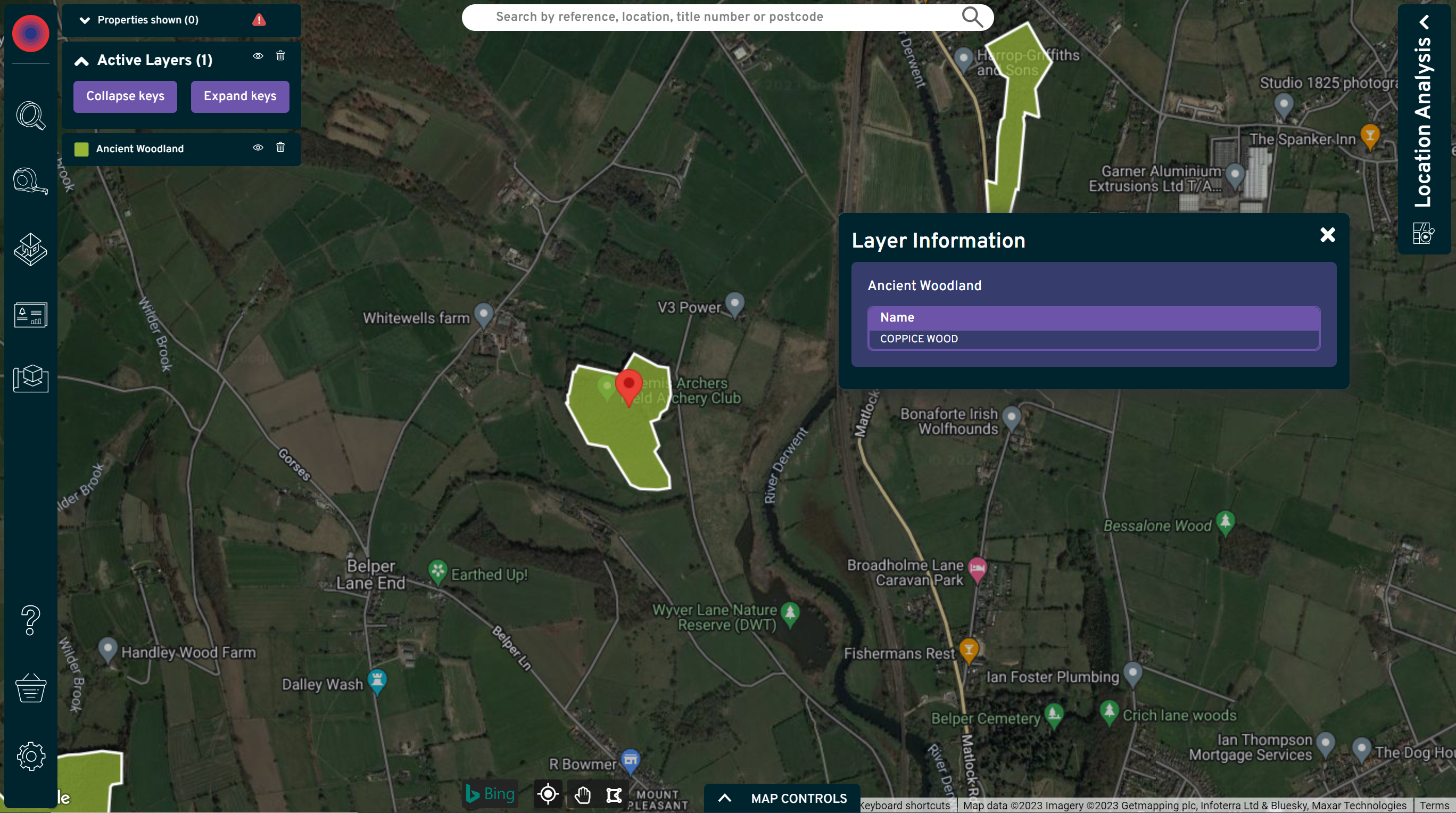
Great news for residential developers, our latest Nimbus product update brings the power of environmental insights straight to your fingertips.
Knowledge is power, and nowhere is this more evident than in the quest to create sustainable, environmentally friendly spaces. Every property professional worth their bricks knows that understanding the ecological implications of a development site is essential, and that includes preserving ancient woodlands.
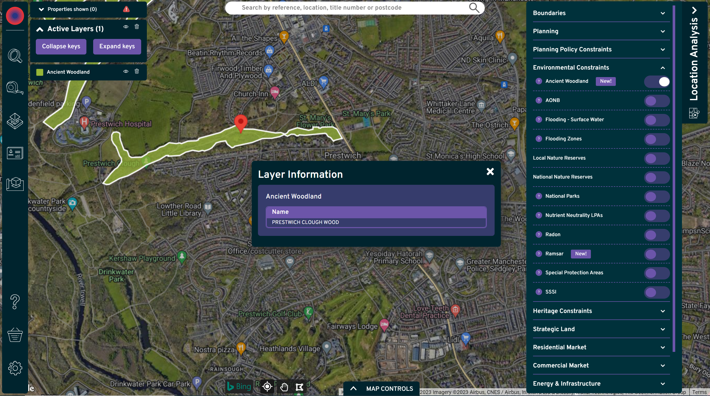
That's why we’re thrilled to introduce the latest jewel in our crown: the New Environmental Constraints Layer for Ancient Woodland, helping you streamline the way you scout for potential development sites.

Understanding the challenge: protecting ancient woodlands
Picture this: you’ve identified a promising opportunity, and you're ready to put the wheels in motion. But there's a catch – the land you're eyeing is near an ancient woodland. Here's where the challenge can often start.
The National Planning Policy Framework (NPPF) dictates that development resulting in the loss or deterioration of irreplaceable habitats, such as ancient woodlands, should be refused, unless there are wholly exceptional reasons, and a suitable compensation strategy exists. In simpler terms, it's a regulatory roadblock.
Attempting any development on a site that's covered by ancient woodland is like swimming against a formidable tide. The chances of receiving planning permission are extremely slim. Not to mention the potential ecological and environmental implications.
The solution?
Introducing our new Environmental Constraints Layer for Ancient Woodland, a game changing addition to our Location Analysis tool. Now, at the click of a button, you can access critical insights into the locations of these protected woodlands.
By overlaying this layer on your development site, you're instantly informed about the proximity of ancient woodlands, and whether your site encroaches on these protected sites.
With this tool, you can:
- Identify risk: quickly and efficiently assess the ecological risk of your development site. If it's near an ancient woodland, you'll know, and you can plan accordingly.
- Prevent regulatory roadblocks: thanks to this transparency, you'll be able to make informed decisions about your site choices. No more stumbling blindly into regulatory traps.
- Enhance your reputation: demonstrating your commitment to environmental preservation can enhance your brand and win over of potential investors.
- Innovate sustainable solutions: If you do find your site bordering an ancient woodland, you can start exploring a suitable compensation strategy.

What's next with Nimbus?
At Nimbus, we value your feedback and continuously strive to enhance your experience. These new features empower you to make more informed decisions, streamline your workflow, and reduce complexities in property development.
Our roadmap is packed with exciting innovations, all designed to make your property analysis even more effective and efficient. We can't wait to share these advancements with you in the near future.
Join us for in-depth insights
To dive deep into these new features and explore the full potential of Nimbus, we invite you to participate in our upcoming webinars. These sessions, led by our experts, offer valuable insights and tips to help you master our platform.
Connect with our support team
If you’d like to know more about how Nimbus and our exciting new features can help take your business to the next level, get in touch with our team today on 01926 355 424 or take our new feature for a test drive today when you sign up for a free trial.
Thank you for choosing Nimbus as your partner in property success. We're excited to continue this journey with you, and we can't wait to show you what's next.
Key reads on the Nimbus blog
The revised National Planning Policy Framework places greater weight on delivery, evidence and outcomes. This article looks at what the changes mean in practice for property professionals assessing planning risk, site viability an...
The Renters Rights Act 2025 is set to reshape the private rented sector, introducing the most wide-ranging changes seen for many years. Much of the public discussion has centred on the benefits for tenants, yet the day-to-day impa...
Modest price growth, tighter regulation and more selective development are set to shape the year ahead, with property professionals relying increasingly on detailed data and local insight. 2026 is shaping up to be a year of steady...
Nimbus has launched a new data intelligence platform designed to give property professionals earlier, clearer insight into market activity. The Complete Comparables Tool combines AI-driven detection with a verified national datase...